
Find Portland Neighbors by Block
For Portland neighbors, begin by separating a parcel question from an occupancy question. The county tax search can return an account through owner name, property address, account number, CAD reference, or fiduciary number. That result can lead to the parcel and its recorded owner. The City of Portland map hub supplies municipal context, including zoning, infrastructure, annexation, appraisal-district, and parks layers. Neither source confirms every person who is presently inside a home. A deed or tax account is evidence of a recorded property connection, and its date matters.
| Block source | Useful Portland detail | Access route |
|---|---|---|
| County tax search | Account and property-address leads, plus owner and CAD-reference search paths | County tax portal |
| City digital maps | Zoning, infrastructure, annexation, appraisal-district, parks, and related map context | Portland digital maps |
| Recorded instruments | Grantor, grantee, dates, legal description, and image-based ownership evidence | County Clerk search |
| Voter data request | A law-governed registration-list route, with protected and suppressed information excluded | Elections request guidance |
| Community contacts | Public civic, library, Chamber, and calendar information, not a household roster | Official local routes below |
Use the owner field carefully. A mailing address can differ from the parcel address, and a recorded grantor or grantee is not necessarily a resident. When the question shifts from the immediate block to a full named street, the address-by-address record chain belongs with the Portland street directory. Keep the parcel number, legal description, record date, and source URL together so a later check can reproduce the result.
Use Portland Parcel Records
San Patricio CAD provides Property Search and Interactive Map entry points, but the direct eSearch and interactive-map portals timed out during research. Their live field labels and parcel cards were not verified, so they should not be treated as an observed neighbor-search interface. The practical fallback is the reachable county tax portal, followed by the City of Portland digital-map hub. The city confirms its ArcGIS maps include zoning, infrastructure, annexation, appraisal-district, and parks layers. Those layers can help identify the setting around a block, but they do not replace a dated county parcel record.
Search one address at a time and compare the displayed parcel with the legal description before connecting it to an instrument. A legal description is the lot, block, tract, or survey language used to identify land. It is often more durable than a street address when an address has changed. For an address that sits near a shoreline or an unusual boundary, confirm the county of the actual parcel. Portland is principally in San Patricio County, but the city plan describes a very small submerged portion in Nueces County.
Bridge Portland Address Records
Portland annexation can make a block search look inconsistent even when the underlying parcel is the same. The city’s annexation guidance says USPS controls the city and ZIP designation, while the city may help with street name and number questions. After an address change, USPS may use the old and new forms for up to 18 months. Retain the original spelling, then compare a USPS-standardized form, the legal description, the County Clerk index, and the applicable city map or annexation ordinance.
A city permit record can add site context without turning into a resident record. The city describes permit materials as including plans that may show property lines, building footprints, easements, and setbacks. The permit and development system handles applications, uploaded documents, and fees, but direct permit pages were not available during research. Treat a permit as a project or property clue, not proof that a person lives on the block.
Note: A tax mailing address, a permit applicant, and a recorded owner may be different people with different roles.
Map Portland Block Records
The closest reliable block method is a sequence of address, parcel, and instrument checks. It does not depend on claiming that a direct CAD map control was seen when it was not. Start with the exact address and work outward only after the map or tax result has supplied a parcel or account reference. A parcel is the defined piece of land in an appraisal or mapping system. The County Clerk’s search is then the route for recorded instruments, while the county QuickLinks collection is the historical route for land-index material before 1983.
- Normalize the supplied street address through USPS, while keeping the original form for comparison.
- Use the county tax portal to locate an account, CAD reference, or property-address result.
- Open the city map hub for the block’s annexation and municipal-layer context, then verify adjacent parcels when the CAD portal is available.
- Use the legal description or party name in the County Clerk index and inspect the instrument image before describing a transfer.
- For older land research, move to the San Patricio QuickLinks collection and then the state archives reel guide if needed.
That flow identifies property relationships, not a complete household. A grantor is the party transferring an interest; a grantee receives it. An image may also contain exceptions, easements, or prior-reference clauses that explain why a name appears. The clerk’s index has a current online route for records described as 1983 forward and a separate historical index path. Read the image rather than relying on a name hit alone.
Check Portland Permit Records
Portland’s permit information describes construction, pool, fence, electrical, plumbing, mechanical, and plan-review work. The public portal route can supply development context for a property, including documents that may show site lines, easements, and setbacks. It is not a neighborhood roster. New residential or commercial permits are described as taking up to 15 business days, while other permits are described as two to five business days, but any timing should be confirmed with Development Services.
Here is the Portland permit portal captured for the records inventory.
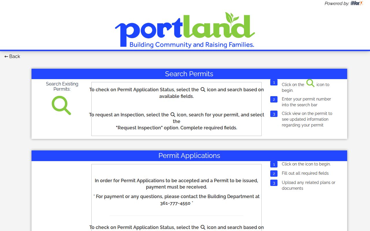
The portal image supports a route for property and development context, not an assertion about a person’s current home.
Find Portland Directory Contacts
No official Portland neighborhood-association umbrella or directory was located. It would be inaccurate to present a fabricated association list as a way to identify neighbors. Public community routes are still useful for learning who organizes an event, where a civic contact belongs, or which local institution can answer a non-personal question. The Chamber directory supports keyword, A–Z, and category browsing, while the city calendar records public events and their organizers. Neither establishes a home address or a member household.
Portland Chamber
Portland Chamber of Commerce lists its office at 720 Dallas St., Suite A, with a community and business directory. The directory is a business-context source.
City Calendar
Portland’s community calendar is the city-hosted route for public events within city limits and can confirm an event date or organizer.
Bell/Whittington Library
Bell/Whittington Public Library is a local contact point for reference help, genealogy, and local-history questions.
The Portland Chamber directory has keyword, category, A–Z, and print controls for public listings.
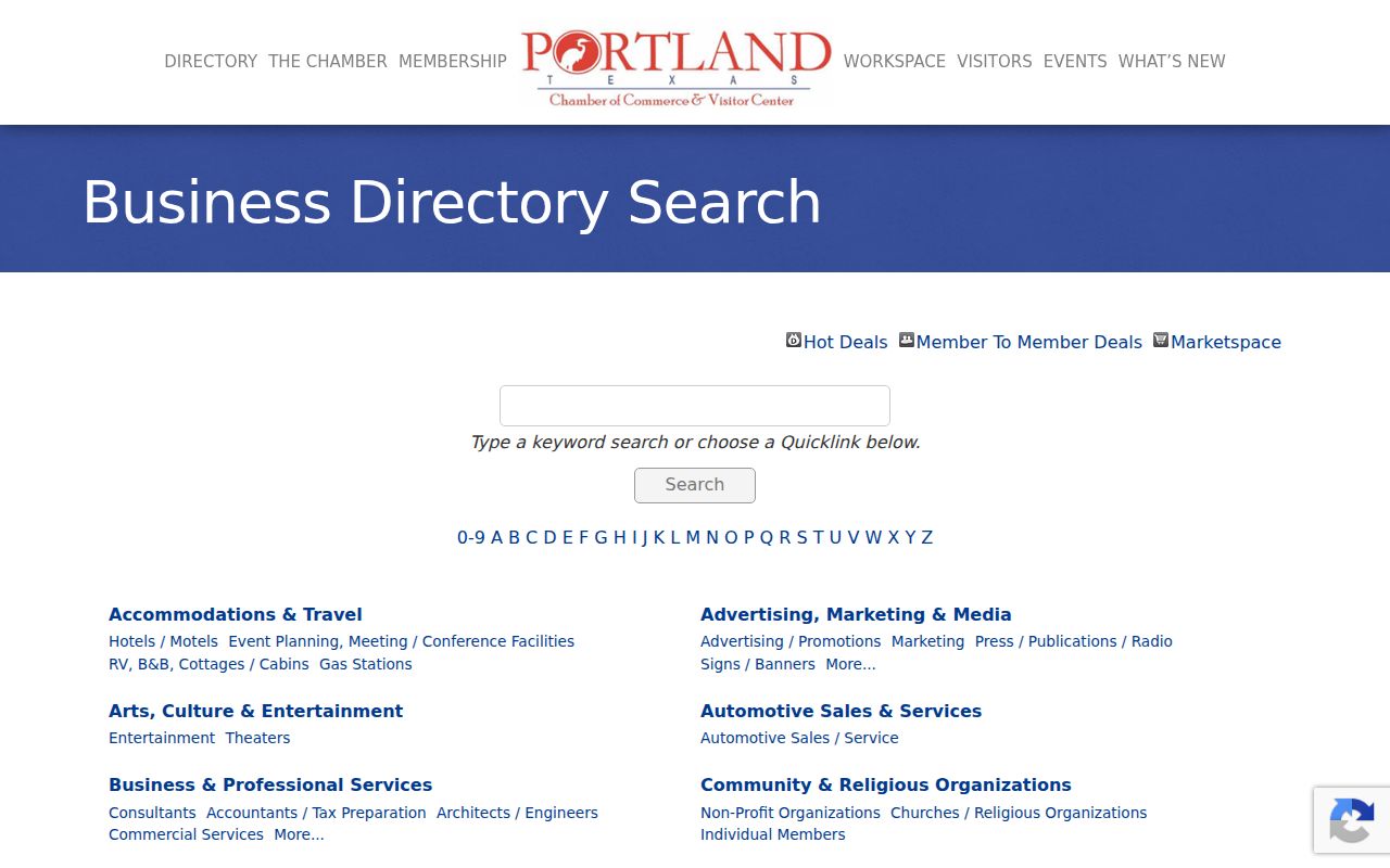
Use a Chamber listing as a dated community or business connection, never as proof that a contact person lives nearby.
Use Portland Civic Directory Routes
The city staff directory is a better route than speculation when a block question belongs with a city department. It offers category, first-name, and last-name controls, and its listed groups include City Secretary, Development Services, Library, Municipal Court, Public Works and Utilities, and Police, Animal, and Code Enforcement. These are civic contacts, not residential information. The City Secretary coordinates central public-information requests, while Police, Fire, and Municipal Court records follow separate city routes.
The Portland staff directory is a current municipal contact tool.
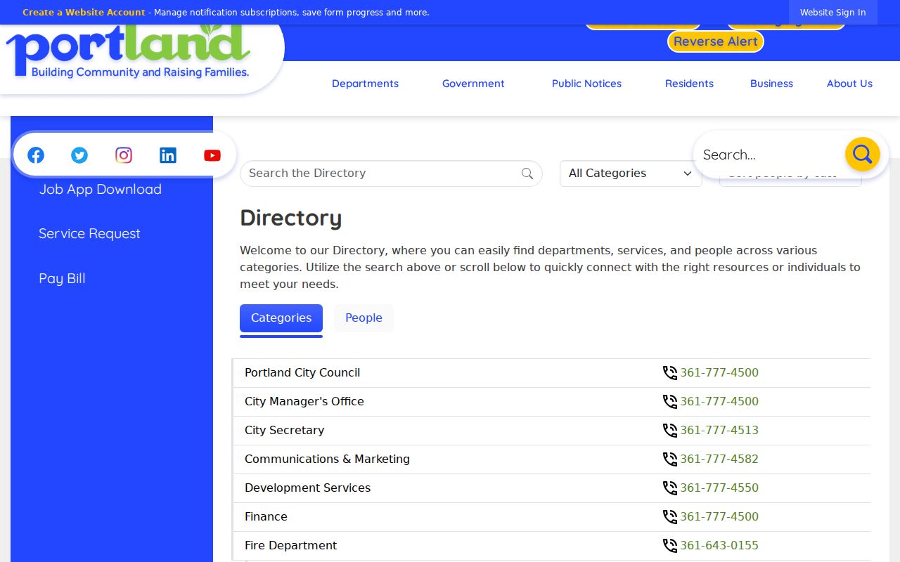
The city directory helps route a civic question to the right office without treating staff information as a block-residence record.
Compare Portland Neighbor Sources
Official records show a defined, dated function of a property or public process. Commercial neighbor-finding tools may combine sources, charge for access, and present information whose collection date and verification path are unclear. A result from either category needs a source date and a check with the issuing custodian. For a property question, an instrument image or tax-account record has a clearer role than an unnamed compiled listing.
| Source type | Best use | Key limit |
|---|---|---|
| Official parcel, tax, and deed routes | Check a recorded property relationship, legal description, or dated filing | Owner and mailing details do not prove present occupancy |
| Official city and community routes | Find a department, event, library resource, or business listing | They do not create a household directory |
| Commercial compiled tools | Provide an unverified lead to test against a custodian | Coverage, cost, accuracy, and update dates may be unclear |
Preserve the source URL and retrieval date for any result, then compare a party name, legal description, or filing date with an issuing-agency record. Older Portland research also needs date awareness: the current Clerk index is described as 1983 forward, QuickLinks covers earlier land-index material, and city map context is not a historic ownership record.
Respect Portland Neighbor Privacy
Texas public-record access has boundaries. The Texas Public Information Act is a way to request existing government records in writing, not a way to require a new analysis or a complete people list. Voter-registration information has specific protections: Social Security, driver-license, and personal-ID numbers are confidential under Election Code §13.004, and voters may use suppression or alternate-address procedures. Election Code §18.009 also restricts using registration lists to advertise or promote commercial products or services.
The Texas Address Confidentiality Program is different from ordinary web suppression. Qualifying victims may use a substitute post-office box and mail forwarding. Do not attempt to work backward from a substitute address through map, tax, directory, or voter clues. Protected officials, sensitive court matters, and redacted records deserve the same restraint. For a public-record request, use the Texas Attorney General’s request guidance and seek only the existing, needed record.
Lawful use. Use Portland neighbor records for personal, lawful research and civic context. Do not use them to watch, harass, intimidate, or harm anyone; Texas harassment and stalking laws make repeated unwanted contact and threatening conduct serious matters.